

PARIMAN: The Geo-Portal for NCR made Public
- In Reports
- 10:27 PM, Jul 08, 2022
- Myind Staff
On Friday, with the intent of optimum utilization of resources in Public interest, National Capital Region Planning Board has made the NCR Geo-portal (PARIMAN) open to Public.
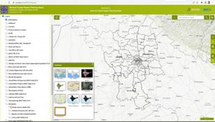
NCR Geo-portal (PARIMAN) is a robust system to facilitate better sub-regional and local planning. It stands for Portal for Analytical Regional Information and Mapping of NCR. This contains various layers collected from authentic sources. The portal has many Base Maps, Satellite Image services and Night Light Data of different time spans. The Portal consists of around 179 Layers presented as Line, Point & Polygon features covering details of various sectors. A Terrain Map provides the Elevation Profile of a route.
Administrative units like State Boundaries to Village Boundaries, various Headquarters to Habitations, Parliamentary and Assembly Constituency Boundaries are integrated into this portal.
Other layers include Road, Rail and Metro Networks, Points of Interest like Education, Health, Banking, Post Office, Power and Telecom, Industries, Tourism, River and Canal Networks and many more.
The Area of Interest function facilitates a comprehensive view of any information about a particular State or District or Tehsil. This Geo-portal is an important platform to know where and what exists in National Capital Region (NCR) that enables better planning.
National Capital Region (NCR) is presently spread over 55,083 Sq. Kms and has four participating states (24 Districts and entire NCT of Delhi) as its constituent area. ‘PARIMAN’ was launched on 31.08.2021 in the 40th meeting of the Board by Shri Hardeep Singh Puri, Chairman, NCRPB and Union Minister for Housing & Urban Affairs.
Image source: PIB


Comments