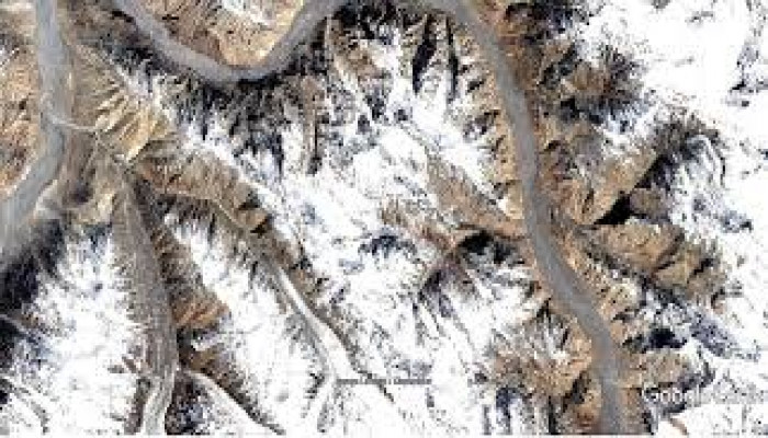
China building new road in occupied Kashmir near Siachen: Satellite images
- In Reports
- 08:29 PM, Apr 25, 2024
- Myind Staff
Satellite images reveal that China is constructing a concrete road in a region of illegally occupied Kashmir near the Siachen Glacier, known as the world's highest battlefield. This road is being built in the Shaksgam Valley, a part of Pakistan-administered Kashmir that was ceded to China in 1963. The road extends from an offshoot of Highway G219 in China's Xinjiang region and disappears into the mountains approximately 50 kilometers north of India's northernmost point, Indira Col, in the Siachen Glacier. This area has strategic significance for India, as evidenced by visits from Defense Minister Rajnath Singh twice since March.
Former commander of the Indian Army's Fire and Fury Corps, Lt Gen Rakesh Sharma, asserts that the construction of this road is entirely illegal, and India should express its diplomatic objection to China. The initial discovery of the construction was raised by an observer of the Indo-Tibetan frontier, known as 'Nature Desai,' on X platform.
The road is situated in the Trans-Karakoram Tract, a region historically considered part of Kashmir and claimed by India. Despite the abrogation of Article 370, the most recent official map published by the Union government still depicts this area as Indian territory.
Covering approximately 5,300 square kilometers, the tract was seized by Pakistan during the 1947 war and subsequently transferred to China as per their bilateral boundary agreement in 1963—a pact not acknowledged by India.
Indian defense experts have consistently argued that any alteration to the status quo in this portion of occupied Kashmir constitutes a violation of India's sovereignty and territorial integrity. There are also apprehensions that additional infrastructure projects of this nature could jeopardise the existing security situation in this mountainous area.
India's concerns are further fueled by reports of increased military collaboration in the region. In 2021, Pakistan's Gilgit-Baltistan province unveiled plans for a new road linking Muzaffarabad to Mustagh Pass, situated on the Pakistan border with the Shaksgam Valley. According to the report, this road would be connected to Yarkand in Xinjiang, suggesting that it might traverse the Shaksgam Valley to join China's national highway G219.
Many observers, including Lt Gen Sharma, speculate that the Chinese roads in the Shaksgam Valley could primarily be intended for transporting minerals, particularly Uranium, purportedly mined from Gilgit Baltistan, to Xinjiang. Nevertheless, he advises maintaining constant vigilance against the potential use of these roads for "military maneuvers" by the armies of Pakistan and China.
The road enters the disputed region at Aghil Pass, historically recognized as the frontier of Kashmir with Tibet—a fact acknowledged by Chinese rulers in the past. Aghil Pass and the Shaksgam Valley are frequently cited in the texts presented by the Indian side to support its claim during border negotiations with China prior to the 1962 war.
"The official maps of the Government of India, including those featured in the 1907 edition of the Imperial Gazetteer of India and political maps published by the Survey of India, depicted this area as part of Indian territory," asserted the Indian delegation led by then MEA director for China affairs, JS Mehta, during discussions with China's foreign office in Beijing in June 1960.
"Official Chinese maps published in 1917, 1919, and 1923 similarly depicted this area as a part of India," as stated in the archive of the Ministry of External Affairs, which is available on the website of renowned Tibetologist Claude Arpi.
India's stance on Pakistan-occupied-Kashmir (PoK) and the Shaksgam Valley has been a longstanding point of contention between the two countries. The Indian government has consistently reiterated its commitment to reclaiming all areas of PoK, including the Shaksgam Valley, which it considers to be a rightful part of its territory.
Despite exercising control over the area for decades, the Chinese occupation lacks political legitimacy. Article 6 of the 1963 Boundary Agreement between China and Pakistan stipulates that China's control over the area is temporary and contingent upon the resolution of the Kashmir issue.
India's engagement with Pakistan along the Line of Control (LoC) is governed by the 1972 Shimla Agreement. However, there is no comparable agreement with Chinese authorities regarding the status of the Shaksgam Valley.
Between 2017 and 2018, China constructed a metalled road in the lower Shaksgam Valley, located to the west of the strategic Karakoram Pass. Reports have also emerged regarding the presence of Chinese military infrastructure in the valley, which Indian military officials reportedly protested during border talks in 2022. These talks followed the deadly clashes in the Galwan Valley in 2020.
In addition to these developments, India lodged strong diplomatic protests with Beijing last year after China officially depicted the Aksai Chin plateau as its territory. Furthermore, in 2015, External Affairs Minister Dr. S Jaishankar stated that India had protested against Chinese plans to invest $46 billion in the China-Pakistan Economic Corridor.
Image Source: Swarajya


Comments